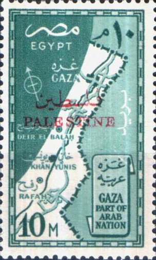
Map of the Gaza Strip - 10 millieme
This highly significant historical stamp was issued by Egypt in 1957 following the withdrawal of foreign troops after the Suez Crisis.The intricate engraving illustrates a geographic map of the Gaza Strip, explicitly identifying its primary urban hubs: Gaza (غزة), Deir El Balah (دير البلح), Khan Yunis (خان يونس), and Rafah (رفح).